From our development portfolio

Selected systems for demanding technical workflows.

Our development portfolio comprises expert software and AI systems for a range of technical workflows. This page presents a selection: SpatialAgents, the Geospatial API for AI agents, Climate Risk and Vulnerability Assessment (CRVA) built on that framework, and Düngewende.

01 / QGIS integration

SpatialAgents

A technical connection between coding agents and a QGIS workstation.

SpatialAgents system architecture: Claude Code, Codex CLI and OpenCode work with the SpatialAgents QGIS plugin through an agent workspace, skills, the Geospatial API and a local token-authenticated bridge; project state, geospatial tools and artefacts return for verification
SpatialAgents / System architectureAgent systems, workspace, Geospatial API, domain skills and the local bridge connect tool calls to QGIS actions and returned project state.
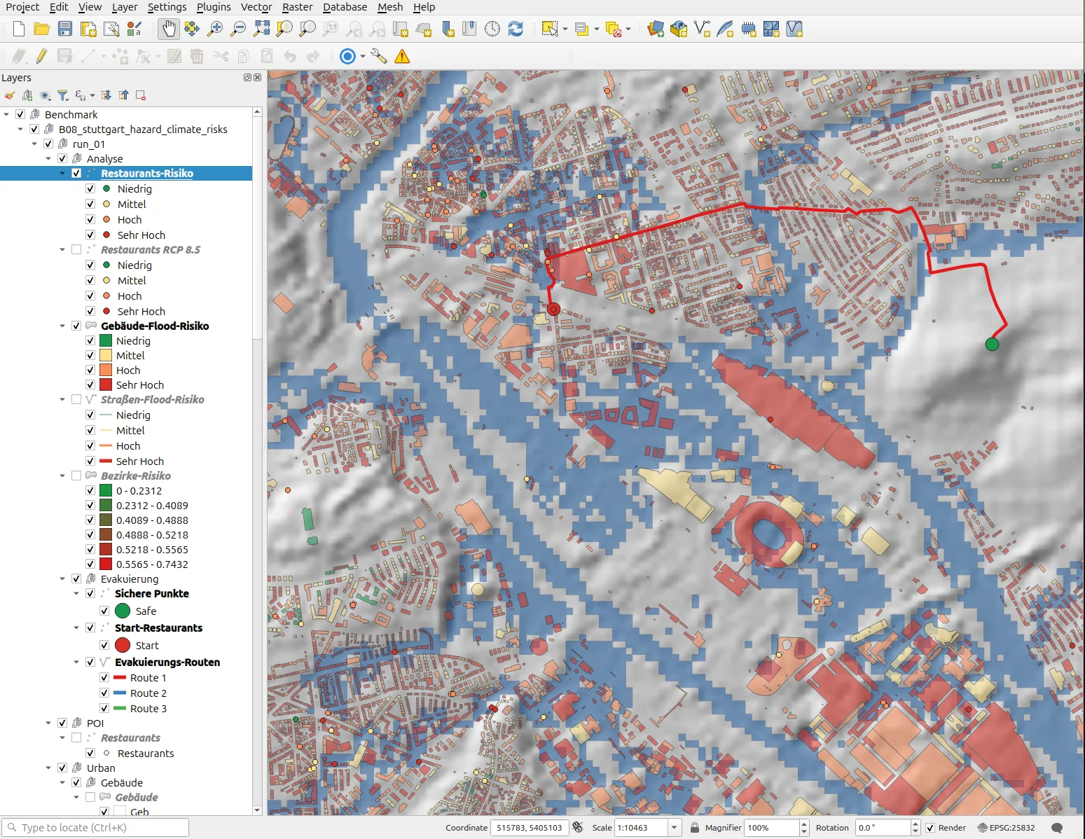
QGIS project from SpatialAgents Benchmark 08 with risk layers and evacuation routes
SpatialAgents / QGISThe open QGIS project with analysis and map artefacts generated through SpatialAgents.
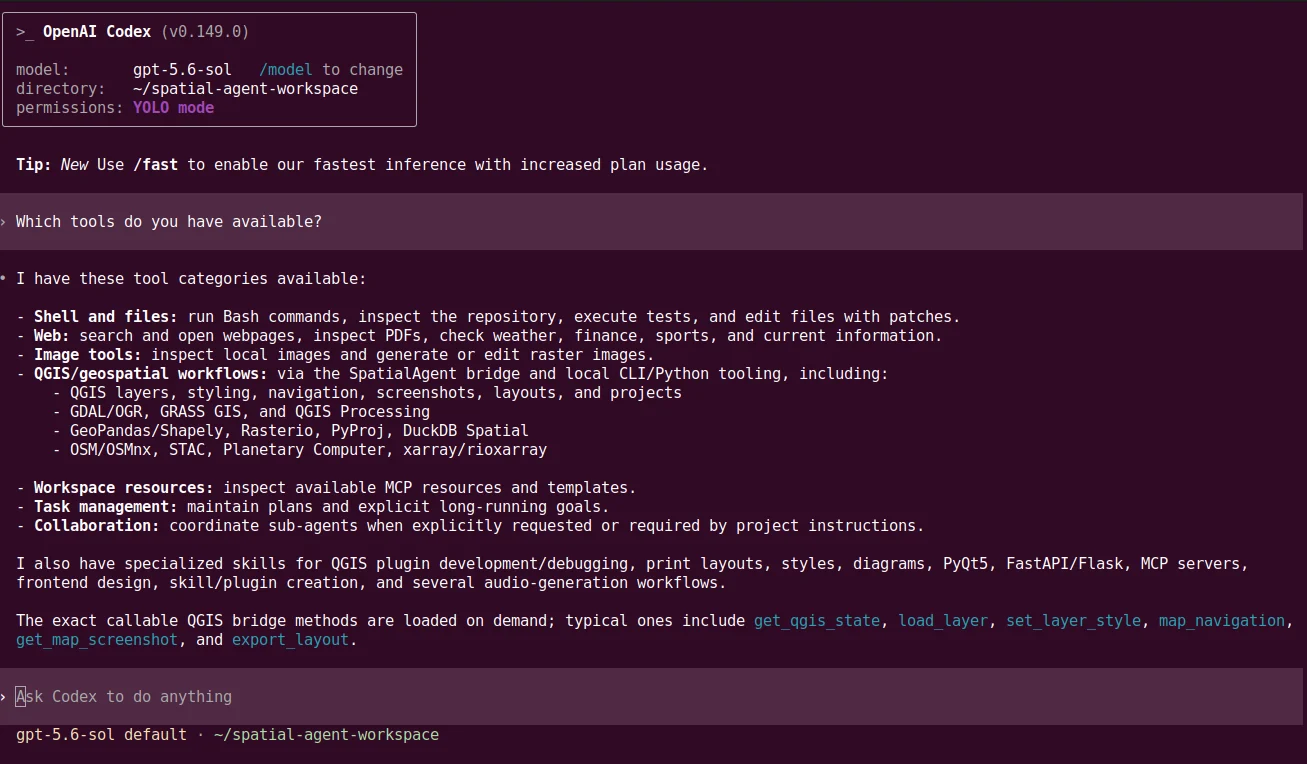
Codex shell in the SpatialAgents workspace with QGIS and geospatial tools
SpatialAgents / CodexCodex and the agents it launches discover the available QGIS and geospatial tools through the SpatialAgents bridge.
Starting point
Coding agents require access to QGIS project state and specialist geospatial tools.
Our development
We develop the QGIS plugin, token-authenticated local bridge, agent workspaces and domain skills as one integrated system.
System
QGIS Desktop, local WebSocket bridge, agent CLI and the Geospatial API used directly in the workspace.
Application
Agents can complete tasks in the open QGIS project and generate map, data and project artefacts.
Fundamentals
Thirteen terms from the coding agent to measured evidence, each with a graphic, reading text and narration; the same sequence is available as a narrated presentation.
Projects and support
We research and develop. Projects, setup, training and support are provided by Geoinformatikbüro Dassau GmbH (GBD).

02 / Geospatial engineering

Geospatial API for AI agents

We develop the Geospatial API specifically for AI agents and continuously improve it through a recursive cycle of agent use, feedback and implementation. It also provides the computational foundation for Climate Risk and Vulnerability Assessment.

System architecture of the Geospatial API designed for AI agents: data from OpenStreetMap, climate, satellite, terrain, statistics and web sources is represented as raster, vector and time-series objects, processed and exported as geodata, maps, tables and reports
Geospatial API for AI agents / System architectureTyped geospatial objects and chained operations form the agent-oriented domain interface of SpatialAgents and the computational foundation of CRVA.
Recursive improvement cycle
AI agents exercise the API in practical geospatial analyses. Their feedback on interfaces, documentation, data types and errors flows back into the API, tests, benchmarks and agent skills.
Direct code use
Coding agents import the framework directly into Python workflows. This applies their code-generation and verification abilities with low token overhead; no MCP server is required.
Self-describing API
Descriptive method names, chainable operations and structured result objects support autonomous use of the interface.
Fault tolerance
Common input errors are caught early. Messages identify the cause, valid values, similar methods and concrete recovery options.
Discuss a use case ↗

03 / Climate-risk analysis

CRVA

Climate Risk and Vulnerability Assessment uses the Geospatial API as its computational foundation and connects geodata, scenarios, analyses, maps and draft reports in one integrated application.

Climate Risk and Vulnerability Assessment workflow: locations and portfolios are combined with spatial context, climate hazards, scenarios and time horizons, assessed for materiality and documented in maps, tables and draft reports
CRVA / Assessment workflowThe data path connects assets, spatial context, hazard fields and climate scenarios with materiality assessment and traceable result artefacts.
Starting point
Site and portfolio assessments bring hazard, terrain and climate data together while documenting uncertainty.
Our development
We develop project management, data preparation, computation, analysis, visualisation and report generation using the Geospatial API.
System
CRVA CLI and pipeline within the Geospatial API, geodata sources, scenario evaluation, maps, tables and draft reports.
Application
Structured draft reports connect data sources, scenarios, analyses, maps and tables for subsequent expert review.

Professional context

CRVA development draws, among other sources, on the steps described in the EU Taxonomy for screening, assessing materiality and identifying adaptation solutions. Professional and legal assessment is carried out for the intended use.

Discuss the technical workflow ↗

04 / Energy & space

Düngewende

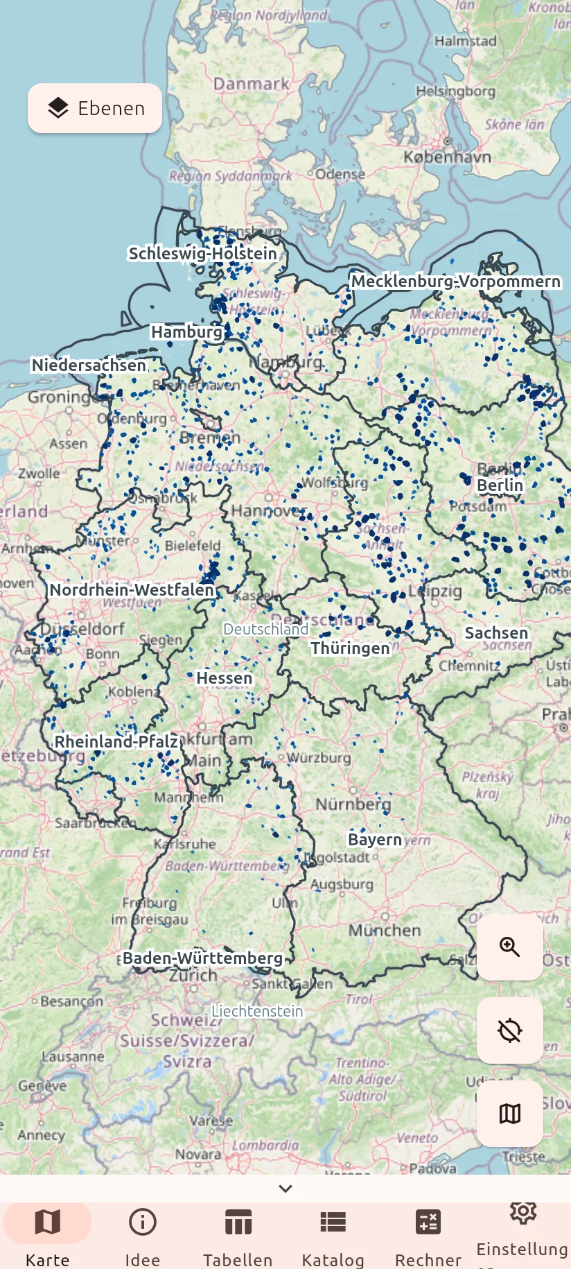
A geodata-based application for site analysis of decentralised green ammonia production.

Starting point
Decentralised green ammonia production connects available wind and solar energy, suitable sites and technical equipment options.
Our development
We develop the specialist application on SpatialApp and bring spatial, technical and economic information into a shared interface.
System
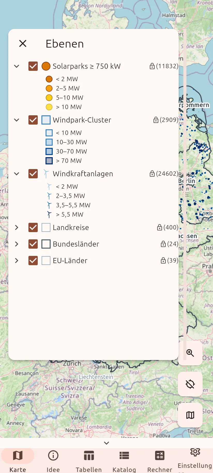
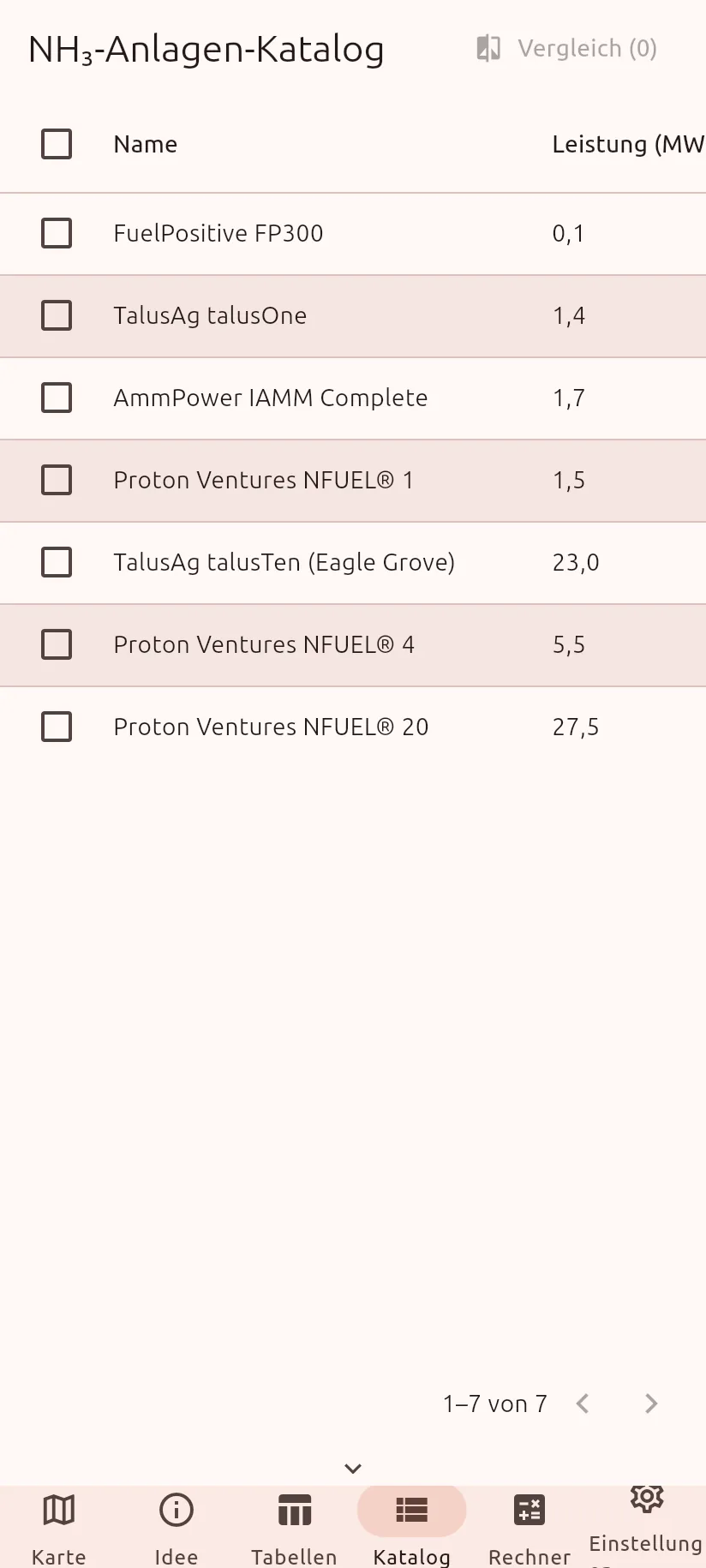
GIS map, wind, solar and cluster layers, site views, equipment catalogue, comparison, reference data and economic calculations.
Application
Maps, tables and domain views support spatial exploration and comparison of possible system configurations.
Discuss Düngewende ↗